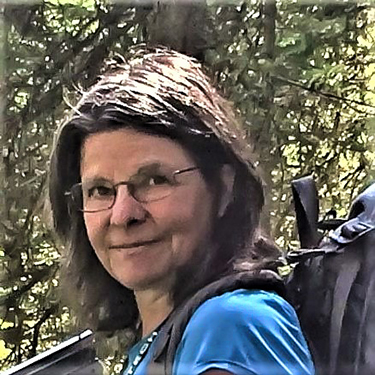

Geologist, Professional Practice Faculty—Professor
Phone: (406) 496-4143
Email: celliott@mtech.edu
MBMG—Butte
1300 West Park Street
Butte, MT 59701
Colleen Elliott's primary focus is on geologic mapping for the USGS Statemap program.
| Date | Citation |
|---|---|
| 1/28/2019 | Elliott, C., 2019, Ringing Rocks of Jefferson County: A Musical Mystery: Presented at Montana Tech, Butte, Montana, January 28, 2019. |
| 4/18/2018 | Elliott, C., 2018, A Rough Guide to Iceland: Presented at the MBMG Brown Bag Seminar, Butte, Montana, April 17, 2018. |
| 2/8/2018 | Elliott, C., 2018, Tripping on the Geology Underfoot: Presented at the Montana Tech Public Lecture Series, Butte, Montana, February 8, 2018. |
| 1/30/2018 | Elliott, C., 2018, MBMG Brown Bag Seminar - The Great Falls Tectonic Zone: Presented to MBMG Staff, Butte, Montana, January 30, 2018. |
| 3/24/2017 | Elliott, C., 2017, Mid-Miocene Unconformity? Mid-Miocene Red Herring?: MBMG Annual Research Meeting, Butte, Montana, March 24, 2017. |
| 5/17/2015 | Vuke, S.M., Thale, P., and Elliott, C., 2015, Creating a Seamless Geologic Map and FGDC Database for Montana: Presented at the 2015 Annual Conference, National Digital Mapping Techniques Annual Conference, Geological Society of America, May 17-20, 2015. |
| 3/1/2014 | Elliott, C.G., 2014, The Story of CFWEP - the Clark Fork Watershed Education Program: Presented at the MEEA Meeting, Butte, Montana, March 2014. |
| Elliott, C.G., 2015, Tertiary Tectonics and Valley Formation in SW Montana: Presented at Hump Day Expose Seminar, Butte, Montana. |
| Year | Citation |
|---|---|
| 2022 | Elliott, Colleen G., 2022, Geologic map of the Pine Hill 7.5' quadrangle, southwest Montana: Montana Bureau of Mines and Geology Geologic Map 87, 1 sheet, scale 1:24,000. |
| 2021 | Elliott, C.G., and Lonn, J.D., 2021, Geologic map of the Foolhen Mountain 7.5' quadrangle, Beaverhead County, Montana: Montana Bureau of Mines and Geology Geologic Map 79, 1 sheet, scale 1:24,000. |
| 2019 | Lonn, J., Elliott, C., Stewart, D., Mosolf, J., Burmester, R., Lewis, R., and Pearson, D., 2019, Geologic Map of the Bannock Pass 7.5' Quadrangle, Beaverhead County, Montana, and Lemhi County, Idaho. MBMG Geologic Map 76, 1 sheet, scale 1:24,000, Butte, Montana, 2019. |
| 2019 | Lonn, J.D., Elliott, C.G., Lewis, R.S., Burmester, R.F., McFaddan, M.D., Stanford, L.R., and Janecke, S.U., 2019, Geologic map of the Montana part of the Salmon 30' x 60' quadrangle, southwestern Montana: Montana Bureau of Mines and Geology Geologic Map 75, 28 p., 1 sheet, scale 1:100,000. |
| 2019 | Scarberry, K.C., Elliott, C.G., and Yakovlev, P.V., 2019, Geology of the Butte North 30' x 60' quadrangle, southwest Montana: Montana Bureau of Mines and Geology Open-File Report 715, 30 p., 1 sheet, scale 1:100,000. |
| 2017 | Elliott, C.G., 2017, Geologic map of the Lincoln Gulch 7.5' quadrangle, southwestern Montana: Montana Bureau of Mines and Geology Geologic Map 70, 1 sheet, scale 1:24,000. |
| 2010 | Lonn, J., and Elliott, C.G., 2010, A walking Tour of the Eocene Anaconda Detachment Fault on Stucky Ridge Near Anaconda, Montana: in Cox, B.E. & Gibson, R.I. eds., The Anaconda Area and Other Papers, 35th Annual Field Conference, Northwest Geology, v. 39, p. 81-90. |
| 2003 | Elliott, C.G., 2003, Review: Lives of a Biologist: The Montana Professor, v. 13, p. 21-22. |
| 2001 | White, J.C., Bleeker, W., Elliott, C.G., Lin, S., and Van Staal, C.R., 2001, Special Issue on Evolution of Structure in Deforming Rocks: Journal of Structural Geology v. 23, p. 834-844. |