IMAGE
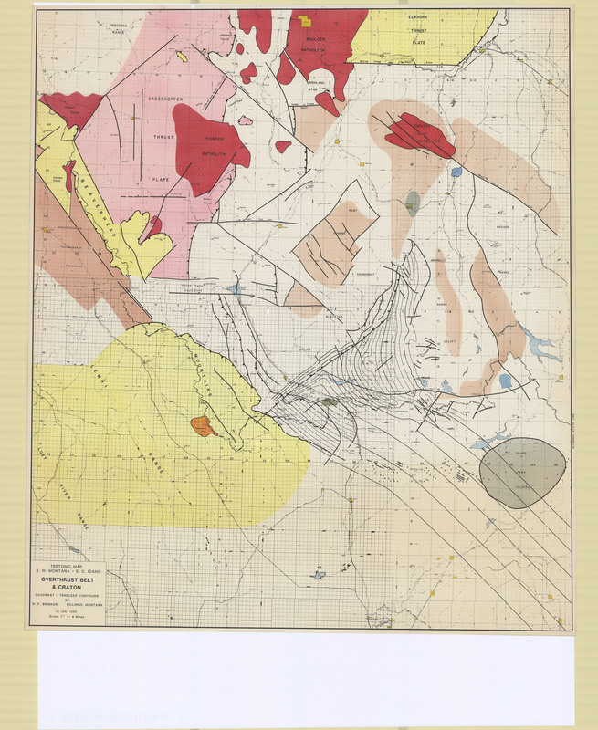
Tectonic Map of Southwest Montana and East Central Idaho, Overthrust Belt and Craton Item Info
- Title:
- Tectonic Map of Southwest Montana and East Central Idaho, Overthrust Belt and Craton
- Creator:
- W.F. Brinker
- Date Created:
- 7/18/1982
- Description:
- Tectonic map with Quadrant/Tensleep structure in SW Montana
- Subjects:
- Contour Map Geologic Map Geophysical Map Seismic Map Structure Contour Map Topographic Map Tectonic Map
- Location:
- Montana; Idaho; Tobacco Root Batholith; Boulder Batholith; Pioneer Batholith; Beaverhead; Elkhorn; Island Park Caldera
- Source:
- MBMG Archives
- Type:
- Image;StillImage
- Format:
- image/jpeg
Source
- Preferred Citation:
- "Tectonic Map of Southwest Montana and East Central Idaho, Overthrust Belt and Craton", Montana Geological Society Maps, Montana Bureau of Mines and Geology
- Reference Link:
- /%5CInformation%5CCollections%5CMontana-Geological-Society/items/mgs012.html
Rights
- Standardized Rights:
- https://rightsstatements.org/page/InC-EDU/1.0/?language=en

