
COMPOUND OBJECT (5 Items)
Shepard Forsyth Project Item Info


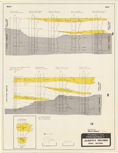

- Title:
- Shepard Forsyth Project
- Creator:
- W.B. Shepard
- Description:
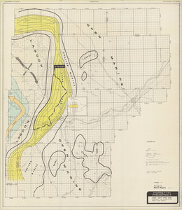
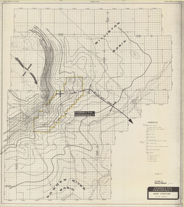
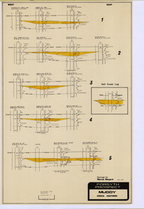
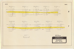
- Maps and cross sections by W.B. Shepard of the Forsyth Area
- Subjects:
- Cross Section Map Cross Section Geologic Map Location Map
- Location:
- Montana; Custer County; Rosebud County; Big Horn County; Treasure County; Prairie County; Garfield County
- Source:
- MBMG Archives
- Type:
- Image;StillImage
- Format:
- image/jpeg
Source
- Preferred Citation:
- "Shepard Forsyth Project", Montana Geological Society Maps, Montana Bureau of Mines and Geology
- Reference Link:
- /%5CInformation%5CCollections%5CMontana-Geological-Society/items/mgs032.html
Rights
- Standardized Rights:
- https://rightsstatements.org/page/InC-EDU/1.0/?language=en