COMPOUND OBJECT (9 Items)
Item Info
P27 Vol. 1 Mountain...

-
Item 1 of 9
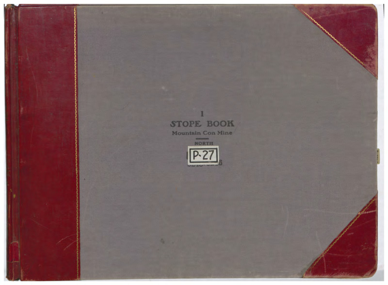
- Title:
- P27 Vol. 1 Mountain Consolidated - North
- Mine(s):
- Mountain Consolidated Green Mountain West Buffalo West Gray Rock Silver Hill Buffalo Little Mina Diamond
- Book Number:
- P27
- Volume:
- 1
- Latitude:
- 46.022304
- Longitude:
- -112.532457
- Source:
- Butte Silver Bow Public Archives
- Type:
- Image;StillImage
- Format:
- application/pdf
Attribution
- Citation:
- "P27 Vol. 1 Mountain Consolidated - North", Butte Stope Books, Montana Bureau of Mines and Geology (MBMG), https://mbmg.mtech.edu/Information/Collections/Butte-Stope-Books/items/bsb195.html#bsb196
Rights
- Rights:
- In Copyright - Educational Use Permitted.
- Standardized Rights:
- http://rightsstatements.org/vocab/InC-EDU/1.0/
P27 Vol. 2 Mountain...

-
Item 2 of 9

- Title:
- P27 Vol. 2 Mountain Consolidated - North
- Mine(s):
- Buffalo Mountain Consolidated West Gray Rock Green Mountain Little Mina Old Glory
- Book Number:
- P27
- Volume:
- 2
- Latitude:
- 46.022304
- Longitude:
- -112.532457
- Source:
- Butte Silver Bow Public Archives
- Type:
- Image;StillImage
- Format:
- application/pdf
Attribution
- Citation:
- "P27 Vol. 2 Mountain Consolidated - North", Butte Stope Books, Montana Bureau of Mines and Geology (MBMG), https://mbmg.mtech.edu/Information/Collections/Butte-Stope-Books/items/bsb195.html#bsb197
Rights
- Rights:
- In Copyright - Educational Use Permitted.
- Standardized Rights:
- http://rightsstatements.org/vocab/InC-EDU/1.0/
P27 Vol. 3 Mountain...
-
Item 3 of 9

- Title:
- P27 Vol. 3 Mountain Consolidated - North
- Mine(s):
- Buffalo Mountain Consolidated Green Mountain Lexington Diamond
- Book Number:
- P27
- Volume:
- 3
- Latitude:
- 46.022304
- Longitude:
- -112.532457
- Source:
- Butte Silver Bow Public Archives
- Type:
- Image;StillImage
- Format:
- application/pdf
Attribution
- Citation:
- "P27 Vol. 3 Mountain Consolidated - North", Butte Stope Books, Montana Bureau of Mines and Geology (MBMG), https://mbmg.mtech.edu/Information/Collections/Butte-Stope-Books/items/bsb195.html#bsb198
Rights
- Rights:
- In Copyright - Educational Use Permitted.
- Standardized Rights:
- http://rightsstatements.org/vocab/InC-EDU/1.0/
P27 Vol. 4 Mountain...

-
Item 4 of 9
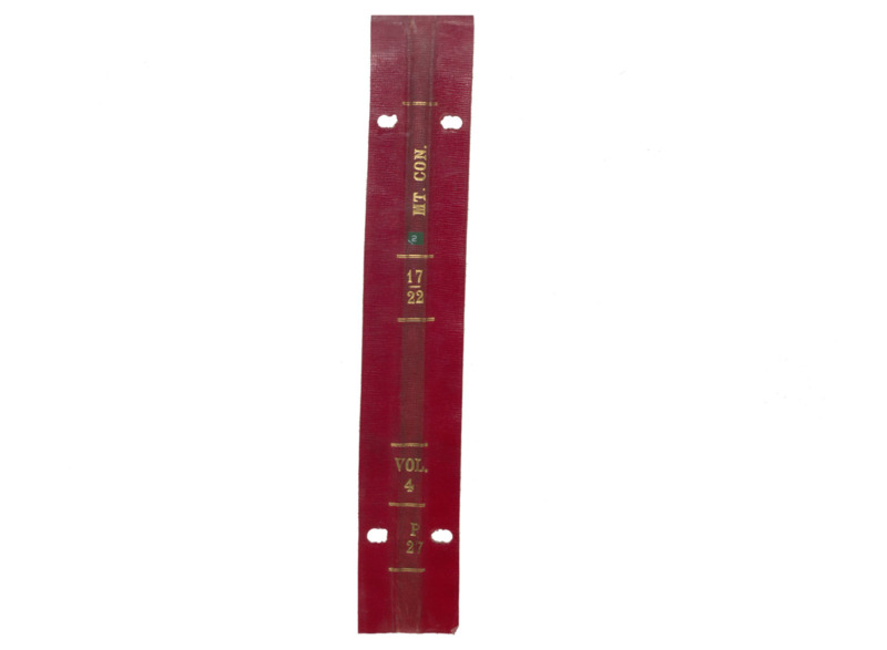
- Title:
- P27 Vol. 4 Mountain Consolidated - North
- Mine(s):
- Mountain Consolidated Diamond Green Mountain Steward
- Book Number:
- P27
- Volume:
- 4
- Latitude:
- 46.022304
- Longitude:
- -112.532457
- Source:
- Butte Silver Bow Public Archives
- Type:
- Image;StillImage
- Format:
- application/pdf
Attribution
- Citation:
- "P27 Vol. 4 Mountain Consolidated - North", Butte Stope Books, Montana Bureau of Mines and Geology (MBMG), https://mbmg.mtech.edu/Information/Collections/Butte-Stope-Books/items/bsb195.html#bsb199
Rights
- Rights:
- In Copyright - Educational Use Permitted.
- Standardized Rights:
- http://rightsstatements.org/vocab/InC-EDU/1.0/
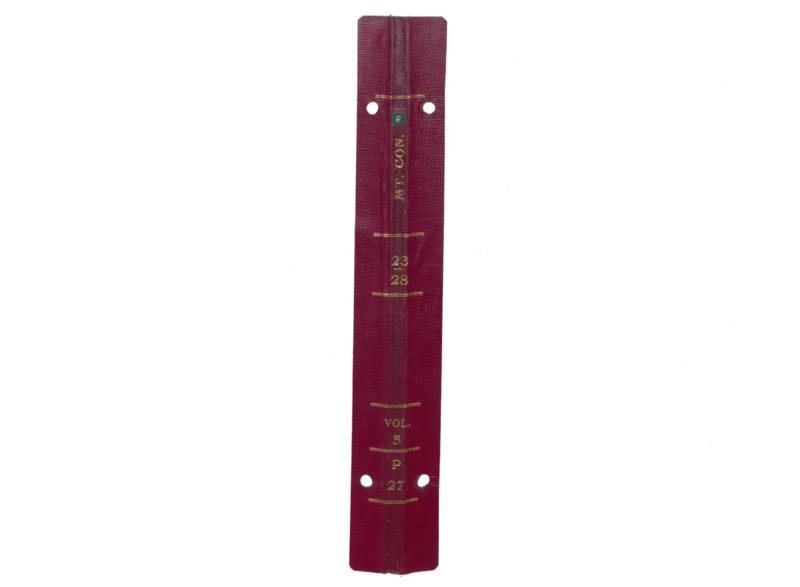
P27 Vol. 5 Mountain...
-
Item 5 of 9
- Title:
- P27 Vol. 5 Mountain Consolidated - North
- Mine(s):
- Steward Mountain Consolidated Diamond
- Book Number:
- P27
- Volume:
- 5
- Latitude:
- 46.022304
- Longitude:
- -112.532457
- Source:
- Butte Silver Bow Public Archives
- Type:
- Image;StillImage
- Format:
- application/pdf
Attribution
- Citation:
- "P27 Vol. 5 Mountain Consolidated - North", Butte Stope Books, Montana Bureau of Mines and Geology (MBMG), https://mbmg.mtech.edu/Information/Collections/Butte-Stope-Books/items/bsb195.html#bsb200
Rights
- Rights:
- In Copyright - Educational Use Permitted.
- Standardized Rights:
- http://rightsstatements.org/vocab/InC-EDU/1.0/
P27 Vol. 6 Mountain...
-
Item 6 of 9

- Title:
- P27 Vol. 6 Mountain Consolidated - North
- Mine(s):
- Mountain Consolidated
- Book Number:
- P27
- Volume:
- 6
- Latitude:
- 46.022304
- Longitude:
- -112.532457
- Source:
- Butte Silver Bow Public Archives
- Type:
- Image;StillImage
- Format:
- application/pdf
Attribution
- Citation:
- "P27 Vol. 6 Mountain Consolidated - North", Butte Stope Books, Montana Bureau of Mines and Geology (MBMG), https://mbmg.mtech.edu/Information/Collections/Butte-Stope-Books/items/bsb195.html#bsb201
Rights
- Rights:
- In Copyright - Educational Use Permitted.
- Standardized Rights:
- http://rightsstatements.org/vocab/InC-EDU/1.0/
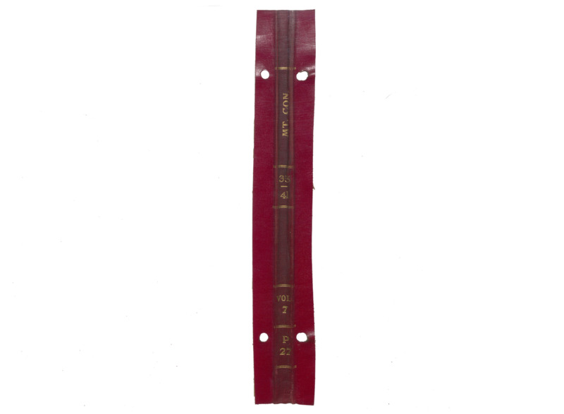
P27 Vol. 7 Mountain...

-
Item 7 of 9
- Title:
- P27 Vol. 7 Mountain Consolidated - North
- Mine(s):
- Mountain Consolidated Diamond Green Mountain Steward
- Book Number:
- P27
- Volume:
- 7
- Latitude:
- 46.022304
- Longitude:
- -112.532457
- Source:
- Butte Silver Bow Public Archives
- Type:
- Image;StillImage
- Format:
- application/pdf
Attribution
- Citation:
- "P27 Vol. 7 Mountain Consolidated - North", Butte Stope Books, Montana Bureau of Mines and Geology (MBMG), https://mbmg.mtech.edu/Information/Collections/Butte-Stope-Books/items/bsb195.html#bsb202
Rights
- Rights:
- In Copyright - Educational Use Permitted.
- Standardized Rights:
- http://rightsstatements.org/vocab/InC-EDU/1.0/
P27 Vol. 8 Mountain...
-
Item 8 of 9

- Title:
- P27 Vol. 8 Mountain Consolidated - North
- Mine(s):
- Mountain Consolidated Diamond Green Mountain Steward
- Book Number:
- P27
- Volume:
- 8
- Latitude:
- 46.022304
- Longitude:
- -112.532457
- Source:
- Butte Silver Bow Public Archives
- Type:
- Image;StillImage
- Format:
- application/pdf
Attribution
- Citation:
- "P27 Vol. 8 Mountain Consolidated - North", Butte Stope Books, Montana Bureau of Mines and Geology (MBMG), https://mbmg.mtech.edu/Information/Collections/Butte-Stope-Books/items/bsb195.html#bsb203
Rights
- Rights:
- In Copyright - Educational Use Permitted.
- Standardized Rights:
- http://rightsstatements.org/vocab/InC-EDU/1.0/
P27 Vol. 9 Mountain...
-
Item 9 of 9

- Title:
- P27 Vol. 9 Mountain Consolidated - North
- Mine(s):
- Mountain Consolidated Diamond Green Mountain Steward
- Book Number:
- P27
- Volume:
- 9
- Latitude:
- 46.022304
- Longitude:
- -112.532457
- Source:
- Butte Silver Bow Public Archives
- Type:
- Image;StillImage
- Format:
- application/pdf
Attribution
- Citation:
- "P27 Vol. 9 Mountain Consolidated - North", Butte Stope Books, Montana Bureau of Mines and Geology (MBMG), https://mbmg.mtech.edu/Information/Collections/Butte-Stope-Books/items/bsb195.html#bsb204
Rights
- Rights:
- In Copyright - Educational Use Permitted.
- Standardized Rights:
- http://rightsstatements.org/vocab/InC-EDU/1.0/
- Mine(s):
- Mountain Consolidated Green Mountain West Buffalo West Gray Rock Silver Hill Buffalo Little Mina Diamond Old Glory Lexington Steward
- Book Number:
- P27
- Volume:
- 1 through 9
- Latitude:
- 46.022304
- Longitude:
- -112.532457
- Type:
- Image;StillImage
- Format:
- image/jpeg
Attribution
- Citation:
- "", Butte Stope Books, Montana Bureau of Mines and Geology (MBMG), https://mbmg.mtech.edu/Information/Collections/Butte-Stope-Books/items/bsb195.html
Rights
- Rights:
- In Copyright - Educational Use Permitted.
- Standardized Rights:
- http://rightsstatements.org/vocab/InC-EDU/1.0/