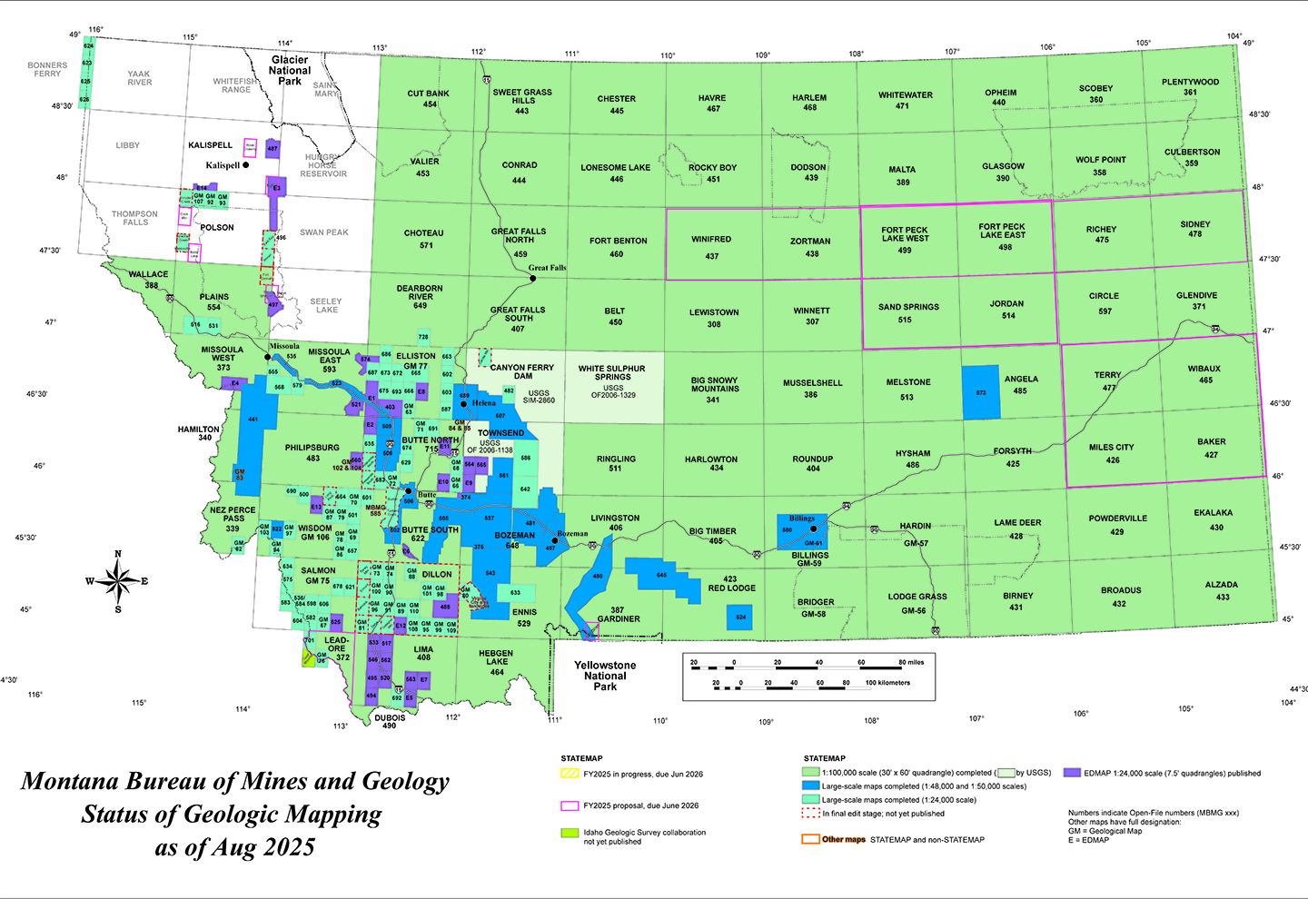
Current Mapping Projects
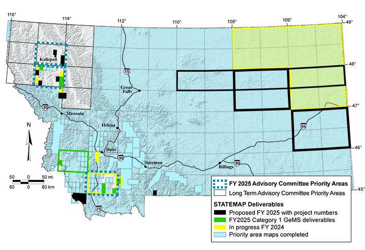
MBMG geologists are currently working on seven mapping projects (fiscal year 2025) supported by the USGS STATEMAP program:
- Detailed geologic mapping of Baldy Lake, Big Fork, Cook Mountain, and Rose Crossing 7.5′ quadrangles;
- Derivative Quaternary fault map of the Saint Marys Lake and Saint Ignatius 7.5′ quadrangles;
- Detailed geologic map of the Gardiner 7.5′ quadrangle;
- Geologic map of the north half of the Leadore 30′ x 60′ quadrangle in Montana (scale 1:100,000);
- Surficial deposit compilation for the 1:100,000-scale seamless geologic map of Montana;
- Subsurface mapping of the Jordan and Miles City 1° x 2° quadrangles, northeast Montana; and
- Submission of MBMG geochronology data to the USGS National Geochron Database.