Virginia City, Madison County
Background
Virginia City currently has approximately 150 year-round residents plus upwards of 300,000 visitors per year during the tourist season. There have been large real estate purchases made by landowners who have expressed interest in developing nearby properties for residential and commercial purposes. Virginia City planners recently updated their Source Water Protection Plan, and noted that they have very little information to protect the two springs that are their sole source of drinking water. There is concern that potential residential and commercial growth in the area above the springs could affect the quality and quantity of the spring water.
Purpose
The purposes of this project are to: 1) determine causes and magnitude of change to Virginia City’s springs that might occur from nearby residential or commercial development; and 2) identify the potential for augmenting the current public water supply with wells.
Project Scope
Detailed geology was mapped at 1:24,000 to better understand the hydrogeology of the springs.
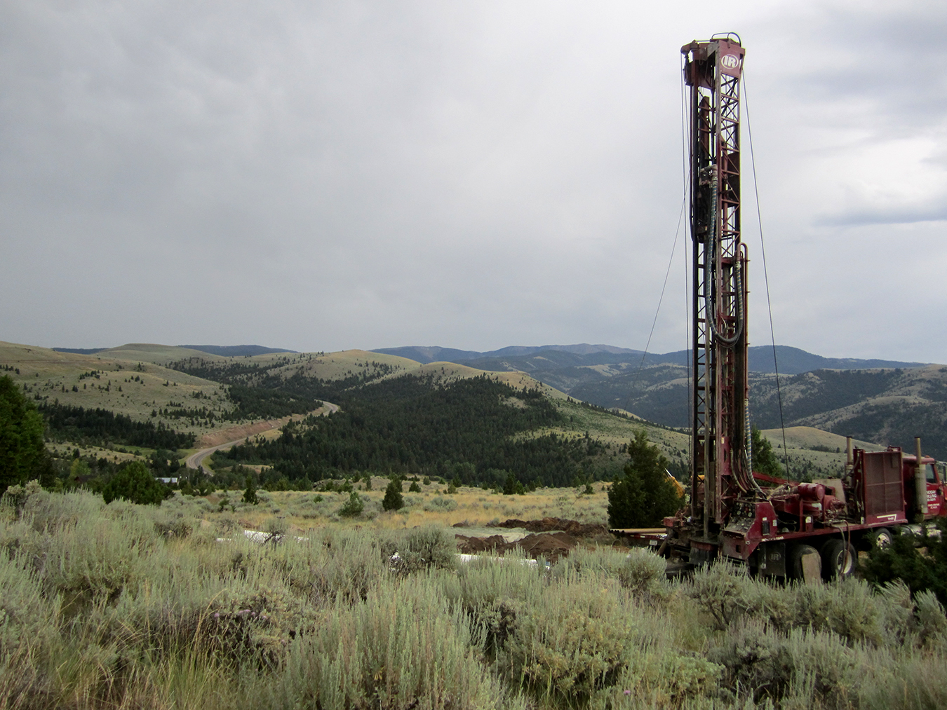
Four wells were installed in the summer of 2017 near the springs to define the local stratigraphy, and to conduct aquifer tests. Aquifer tests provided information on the transmissivity, horizontal hydraulic conductivity, vertical hydraulic conductivity, and storativity of the aquifer. Detailed geologic mapping (1:24,000 scale) and geophysical surveys were performed to help understand the source of spring flows as it relates to geology.
The springs used by Virginia City, peripheral springs, wells, precipitation, and surface waters were monitored and sampled for water chemistry to understand the interconnection and the source of the springs. Groundwater age dating helped to evaluate the extent of the flow system.
Results
The springs that supply Virginia City’s water are contact springs which discharge at the contact between overlying lava flow deposits and underlying volcanic tuff. These springs may be impacted by spills and septic discharges in their recharge zones, since the overlying fractured lava flow deposits are quite permeable. The most promising alternative water sources appear to be other springs, surface water from Alder Gulch, and groundwater in the alluvium along Alder Gulch.
Project Reports
- An investigation of spring sources and potential alternative water supplies near Virginia City, Montana (Bobst, A.L., Michalek, T., and Mosolf, J., 2022)
View in Catalog - Geologic map of the Virginia City 7.5' quadrangle, Madison County, Montana (Mosolf, Jesse G., 2021)
View in Catalog - Landslide map of the Virginia City area, Madison County, Montana (Mosolf, Bobst and Crowley, in prep).
- Khalil, M.A., Bobst, A. & Mosolf, J. Utilizing 2D Electrical Resistivity Tomography and Very Low Frequency Electromagnetics to Investigate the Hydrogeology of Natural Cold Springs Near Virginia City, Southwest Montana. Pure Appl. Geophys. 175, 3525–3538 (2018). https://doi.org/10.1007/s00024-018-1865-2
- Virginia City Aquifer Test (Bobst, Andrew L., 2020)
View in Catalog
Download report (16.2 MB)
Download map (21.6 MB)
Download Appendix A data (43 KB)
Download Appendix B data (11.8 MB)
Download Appendix C data (90 KB)
Download GIS Data Bundle (18.4 MB)
Download report (1.5 MB)
Presentations
- Virginia City June 2022
View Presentation - An Overview of the Virginia City Groundwater Investigation. Montana American Water Resources Meeting, Butte, Montana. October 2020.
View Presentation - An Update on MBMG’s Virginia City Groundwater Investigation. Presentation for the Virginia City Commission, September 7, 2017.
View Presentation
Link to Project Data
Data collected for this project can be accessed through the Ground Water Information Center (GWIC) database:
Download project data from GWIC
Program Resources
Contact Information
Program Information
Ginette Abdo, GWIP Manager
(406) 496-4152 | Email