GWIP Reports
This page contains links to the reports/publications that are products of the different GWIP projects. You will also find these reports listed under the individual projects.
Big Sky (Gallatin and Madison Counties)
- MBMG 742—Groundwater model of the Meadow Village aquifer at Big Sky, Montana, 2021
- MBMG 747—Hydrogeology and groundwater availability at Big Sky, Montana, 2022
Belgrade and Manhattan (Gallatin County)
- MBMG 756—Hydrogeologic investigation of the Belgrade-Manhattan area, Gallatin County, Montana: Superposition groundwater modeling report, 2023
Boulder River Valley (Jefferson County)
- IP 12—Groundwater/surface-water study in the Boulder Valley: Effects of groundwater withdrawal, 2017
- MBMG 688—Hydrogeologic investigation of the Boulder Valley, Jefferson County, Montana, Groundwater modeling report, 2017
- MBMG 682—Hydrogeologic investigation of the Boulder Valley, Jefferson County, Montana, Interpretive report 2016
Clear Lake (Sheridan County)
- MBMG 738—Hydrogeology and water management of the Clear Lake aquifer, with emphasis on the South Medicine Lake management area, 2021
- MBMG 720—South Medicine Lake area of the Clear Lake aquifer: Groundwater model report, 2019
East Flathead Valley (Flathead County)
- MBMG 770—Evaluation of roto-sonic cores and a lithologic cross section in the east Flathead Valley, 2025
- MBMG 757—Analyses of three constant-rate aquifer tests, East Flathead Valley, northwest Montana, 2023
- RI 36—A groundwater flow model for the East Flathead Valley, Flathead County, Montana, 2024
- RI 38—Hydrogeologic investigation of the East Flathead Valley, Flathead County, Montana, Interpretive report, 2025
Ennis (Madison County)
- MBMG 763—— Analyses of constant-rate aquifer tests in the Quaternary-Tertiary basin-fill sediments and the Tertiary-Archean fractured bedrock near Ennis, Montana, 2024
Eureka (Lincoln County)
- MBMG 764—— Three aquifer tests in the Tobacco Valley, near Eureka, Montana, 2024
Flathead Valley (Flathead and Lake Counties)
- MBMG 752—An evaluation of the unconsolidated hydrogeologic units in the south-central Flathead Valley, Montana, 2022
- MBMG 703—Three-dimensional hydrostratigraphic model of the subsurface geology, Flathead Valley, Kalispell, Montana, 2018
- RI 32—Hydrogeologic investigation of the deep alluvial aquifer, Flathead Valley, Montana, 2022
Four Corners (Gallatin County)
- MBMG 735—Hydrogeologic investigation of the Four Corners area, Gallatin County, Montana, Interpretive report, 2020
- MBMG 652—Hydrogeologic investigation of the Four Corners study area, Gallatin County, Montana, Groundwater modeling report, 2014
Hamilton (Ravalli County)
- MBMG 759—Groundwater quantity and quality near Hamilton, Montana, Interpretive Report, 2023
- MBMG 739—Aquifer tests completed in the Bitterroot Valley, Hamilton, Montana, 2021
Lolo Creek (Missoula County)
- MBMG 754—A compilation of two aquifer tests completed for the Lolo GWIP Project, Lolo Creek (Missoula County),2022
Lower Beaverhead River (Beaverhead County)
- MBMG 637—Hydrogeologic investigation of the Beaverhead River study area, Beaverhead County, Montana, Interpretive report, 2013
- MBMG 638—Hydrogeologic investigation of the Beaverhead River study area, Beaverhead County, Montana, Groundwater modeling report, 2013
Lower Big Hole River (Beaverhead and Madison Counties)
- MBMG 775—Temperature and site data for groundwater seeps, tributaries, and tailwater returns to the Big Hole River near Glen, Montana, 2025
- MBMG 773—Analyses of three constant-rate aquifer tests in the lower Big Hole watershed near Glen, Montana, 2025
- IP 17—Groundwater inputs to rivers and streams: Using temperature and visual cues on the Big Hole River, southwestern Montana, 2024
- Hydrological Processes article—An approach for Identifying River Reaches Sensitive to Warming from Daily Solar Radiation, v. 39, e70334.
Musselshell River (Rosebud and Petroleum Counties)
- IP 15—Sources of salinity to the Musselshell River: Executive summary, 2023
- RI 35—Sources of salinity to the Musselshell River, Musselshell County, Montana, 2023
North Hills (Lewis and Clark County)
- MBMG 654—Groundwater/surface-water study in the Boulder Valley: Effects of groundwater withdrawal, 2017
- MBMG 628—Hydrogeologic investigation of the Boulder Valley, Jefferson County, Montana, Groundwater modeling report, 2017
- MBMG 610—Hydrogeologic investigation of the Boulder Valley, Jefferson County, Montana, Interpretive report, 2016
Powder River Basin
- MBMG 640 — Spring and stream water quality, Powder River Basin, Montana, 2013
- Journal of Hydrology article—Coal aquifer contribution to streams in the Powder River Basin, Montana, v. 537, pp. 130-137.
Scratchgravel Hills (Lewis and Clark County)
- MBMG 646—Hydrogeologic investigation of the Scratchgravel Hills study area, Lewis and Clark County, Montana, Technical report, 2013
- MBMG 643—Hydrogeologic investigation of the Scratchgravel Hills study area, Lewis and Clark County, Montana, Groundwater modeling report, 2013
- MBMG 636—Hydrogeologic investigation of the Scratchgravel Hills study area, Lewis and Clark County, Montana, Interpretive report, 2013
Sidney West Crane Buried Valley Aquifer (Richland County)
- MBMG 774—Groundwater model of the West Crane aquifer, Richland County, Montana, 2025
- MBMG 769—Hydrogeology and irrigation potential of the West Crane aquifer, Richland County, Montana, Interpretive Report, 2023
- MBMG 737—West Crane aquifer test summaries, Richland County, Montana, 2021
- IP 13—West Crane buried valley aquifer: A hidden resource, 2020
Stevensville (Ravalli County)
- MBMG 733—Hydrogeologic investigation of the Stevensville study area, Ravalli County, Montana, Interpretive report, 2020
Upper Gallatin River, Big Sky (Gallatin County)
- MBMG 750—Aquifer tests completed in the Upper Gallatin River Valley, Big Sky, Montana
- MBMG 771—Groundwater model of the Upper Gallatin aquifer at Big Sky, Montana, Groundwater modeling report, 2025
- MBMG 772—Hydrogeologic investigation of the Upper Gallatin River Corridor, Big Sky, Montana, Interpretive report, 2025
Upper Jefferson Valley (Jefferson and Madison Counties)
- IP 14—Groundwater/surface-water study in the Upper Jefferson Valley, Montana: Modeling the effects of changing irrigation practices and increased residential development on low streamflows, 2023
- RI 27—Hydrologic investigation of the Upper Jefferson River Valley, Montana: Whitehall Modeling Report, 2020
- MBMG 727—Aquifer tests in the Upper Jefferson Valley, 2020
- RI 28—Hydrogeologic investigation of the Upper Jefferson Valley, Montana-Interpretive report, 2021
- RI 29—Hydrogeologic investigation of the Upper Jefferson River Valley, Madison and Jefferson Counties, Montana: Waterloo groundwater modeling report, 2021
Virginia City (Madison County)
- MBMG 726—Virginia City, Montana, Aquifer test report, 2020
- RI 30—An investigation of spring sources and potential alternative water supplies near Virginia City, Montana, 2022
Other
- MBMG 755 — Investigation of the inorganic groundwater quality in the West Yellowstone Basin, Gallatin County, Montana, 2023
- MBMG 655 — A MODFLOW tool to define boundaries of a stream depletion zone, 2014
- MBMG 612 — Hydrogeology related to exempt wells in Montana: A Report to the 2010–2012 Water Policy Interim Committee of the Montana legislature, 2012
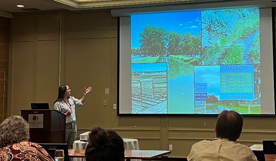
Presenting and answering questions related to groundwater and surface-water information to the public
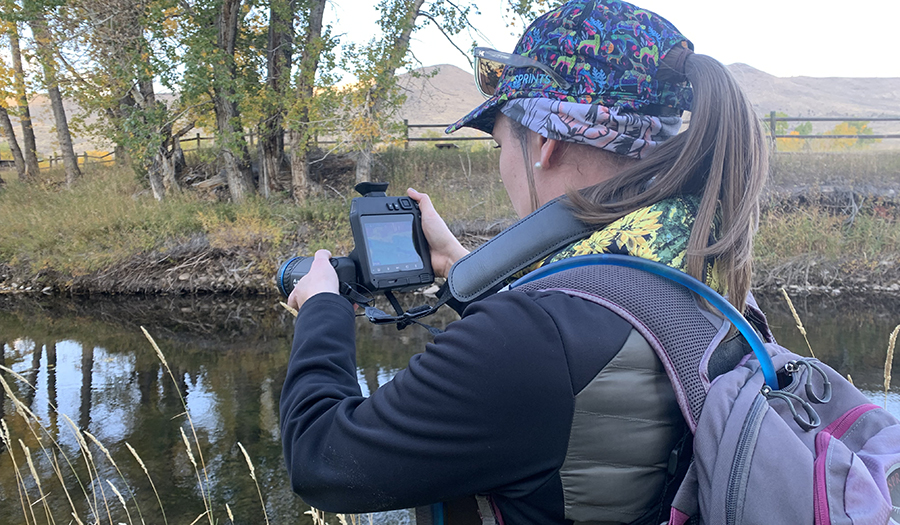
Using thermal-infrared imagery to detect cold groundwater from warm surface water during fall to help understand groundwater/surface-water interactions
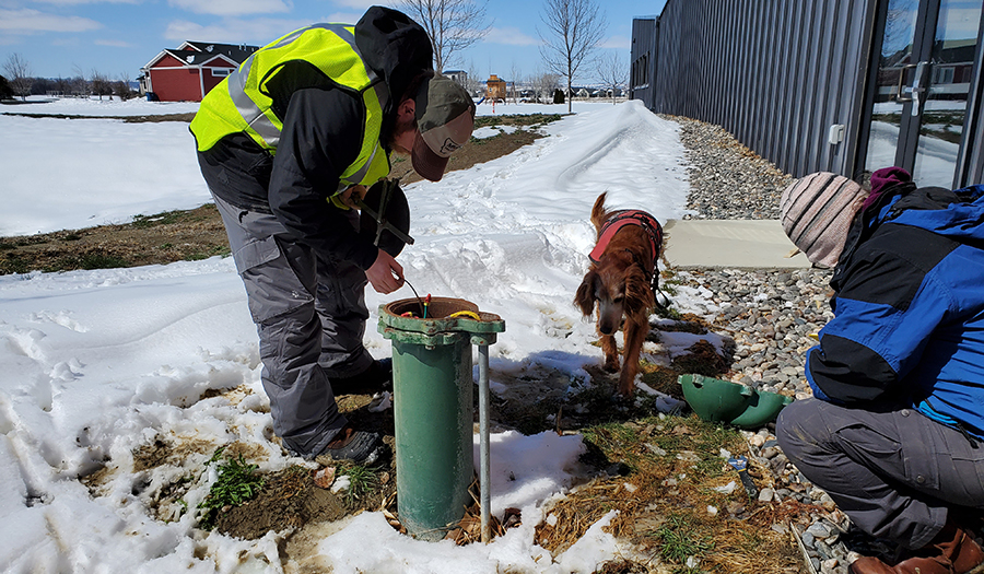
Measuring groundwater levels in Billings, MT which is used to understand changes in aquifer storage throughout the year
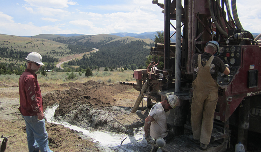
Drilling wells in key locations provides information on aquifer properties and groundwater levels across a study area