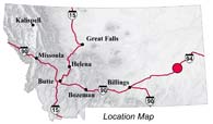
| Navigation | Equipment | Culbertson | White Cliffs | Great Falls | Gates of the Mountains | Three Forks | Beaverhead Rock | Pompeys Pillar | Terry |
Lewis and Clark in Montana — a geologic perspective
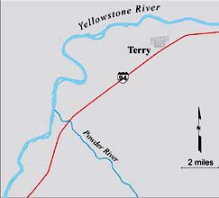
Powder River and the Terry Badlands
 As Clark descended the
Yellowstone River he dutifully noted the many natural features
he saw. A modern traveler here still can see and appreciate what
he described:
As Clark descended the
Yellowstone River he dutifully noted the many natural features
he saw. A modern traveler here still can see and appreciate what
he described:
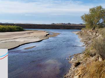
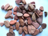
Friday July 30th, 1806 At the mouth of the Powder River, Clark noted:
. . . the water . . . is 100 yds wide, the bead to this river nearly ¼ of a mile this river is Shallow and the water very muddy and of the Colour of the banks a darkish brown. I observe great quantities of red Stone thrown out of this river that [and] from the appearance of the hills at a distance on its lower Side induced me to call this red Stone river
The
Powder River flows into |
 |
||
 |
|||
Photo
by Ginette Abdo, MBMG |
|||
MBMG |
|||
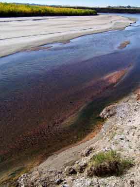 |
The red rocks in and near this stream induced Photo by Clay Schwartz, MBMG
|
|
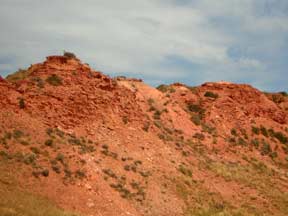
The next day, July 31, Clark continued downstream about 7 miles past Powder River to present-day Terry, Montana. Clark July 31, 1806
|
||||||||||||||||||||||||||


The high Country is entirely
bar of timber. great quantities of Coal or carbonated wood is to be seen in every Bluff and in the high hills at a distance on each Side.
Photo courtesy of Wayne Mumford (www.waynemumford.com)
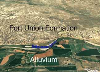
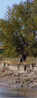
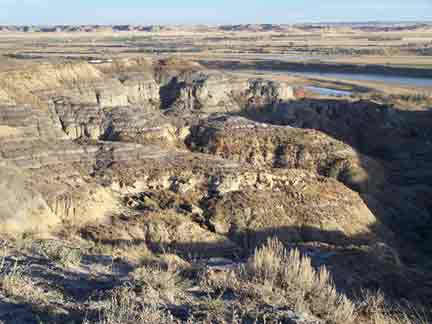
The rugged hills on the N.W. Side of
the Yellowstone are the Terry badlands carved out of the Fort Union
Formation.The darker, patterned, flat area south of the river is
flood plain alluvium, formed by modern erosion and flood deposits. 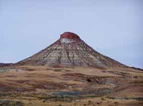
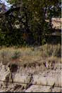
These mounds are capped with erosion-resistant clinker — shale and siltstone that were baked when the underlying coalbeds burned
 Photos by Ginette Abdo, MBMG
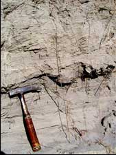
The dark layers are coal formed 65-55 million years ago from the decay of vegetation in a swampy area
. . . I observe Several Conical pounds [mounds] which appear to have been burnt.
. . . great quantities of Coal or carbonated wood is to be seen in every Bluff and in the high hills at a distance on each Side.
Lewis and Clark sometimes called the coal of eastern Montana and western North Dakota “carbonated wood” because it contained the remains of the woody plant material. This low-grade coal is lignite.
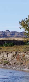
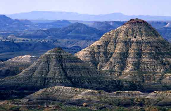
Sediment . . . erosion . . .badlands...
The curious landscape Clark described resulted from erosion of the Fort Union Formation.
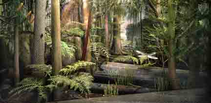
 Altitudes near Terry range from 2200 to 2500
feet above sea level; the climate is semi-arid. About 65–55 million
years ago, however, vegetation grew abundantly here in
a moist, subtropical climate near sea level.
Altitudes near Terry range from 2200 to 2500
feet above sea level; the climate is semi-arid. About 65–55 million
years ago, however, vegetation grew abundantly here in
a moist, subtropical climate near sea level.
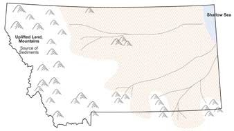
Rivers flowing eastward from the mountains toward the inland sea deposited sand, silt, and mud.
MBMG
 |
| Image courtesy of The Field Museum, photographer John Weinstein ©1991 |
Woodlands, grasslands, and swamps were interspersed in the area. As plants in the swamps died their remains accumulated and slowly turned to peat.
When the rivers meandered or flooded, layers of sand, silt and clay buried the partially decomposed vegetation (peat) in the swamps.
Through geologic time the clay, silt and sand became mudstone, siltstone, and sandstone, respectively. The peat became coal.
 Sandstone and clinker of the
Fort Union Formation tend to resist erosion; they often cap hills
and buttes in the area. The finer-grained siltstone and mudstone
of this formation erode more easily.
Sandstone and clinker of the
Fort Union Formation tend to resist erosion; they often cap hills
and buttes in the area. The finer-grained siltstone and mudstone
of this formation erode more easily.
Rivers and seasonal streams cut through the flat-lying rocks, forming the canyons, ravines, gullies, and hoodoos typical of a badland landscape.
Photo by Ginette Abdo, MBMG
| Navigation | Equipment | Culbertson | White Cliffs | Great Falls | Gates of the Mountains | Three Forks | Beaverhead Rock | Pompeys Pillar | Terry |