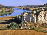
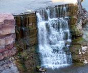
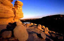
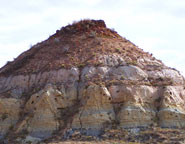
| Navigation | Equipment | Culbertson | White Cliffs | Great Falls | Gates of the Mountains | Three Forks | Beaverhead Rock | Pompeys Pillar | Terry |
Lewis and Clark in Montana — a geologic perspective
"The object of your mission is to explore the Missouri river, & such principal stream of it, as, by it's course & communication with the water of the Pacific ocean may offer the most direct & practicable water communication across this continent, for the purposes of commerce.
. . . Other objects worthy of notice will be; the soil & face of the country . . . the animals...the remains or accounts of any which may be deemed . . . extinct; the mineral productions of every kind; but more particularly metals, limestone, pit coal, & saltpetre, salines & mineral waters, noting the temperature of the last, & such circumstances"
Excerpt from instructions written by President Thomas Jefferson to Meriwether Lewis, June 20, 1803
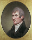
Meriwether Lewis
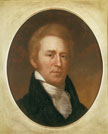
William Clark by Charles Willson Peale Photos courtesy of the |
The Science of Geology
and Lewis and Clark in the early 1800s The science of Geology was in its infancy at the time of the Lewis and Clark Expedition. Neither Lewis nor Clark had any training in geology, mining, or mineralogy. The geologic terms they used, however, reveal much about their understanding (and misunderstanding) of geology. Their journal entries name several rock types: chalk, flint, flintstone, freestone, granite, lava, limestone, marble, marl, pumicestone, sandstone, sandrock, slate, slate stone, and slate rock. Generally, the captains identified these rock types correctly – but not always. The captains were acquainted with names of many minerals, nevertheless most of the minerals and salts that they described were identified incorrectly. Lewis and Clark sometimes ascribed colors to rocks that probably resulted from conditions of sunlight, shadow or vegetation rather than to actual color of the rocks themselves. Both captains had a good command of geographic terms and used most of them in their current meaning. Both also seemed to have had some concept of geologic time because they occasionally used the phrase, “in some former age” when referring to river changes and certain geographic features. Both Lewis and Clark had more of an understanding of stream erosion and deposition than did most people of the time, and the geologic observations they made during the expedition were among the finest of the day in America. |
Little information has reached the public detailing the geography, geology, minerals or fossils that Lewis and Clark described in their journals. These pages depict and explain some of the more important geological observations and navigational aspects that the expedition recorded while within the present state of Montana.
Text by Bob Bergantino and Ginette
Abdo; images as cited; graphics by Susan Smith; web adaptation
by Nancy Favero.
A PDF file for the Lewis and Clark section only is available to download (2.7 Mb). You
can also purchase these pages
as posters (MC21A-I) from our online catalog.
Click
within the map or in the list below for more information.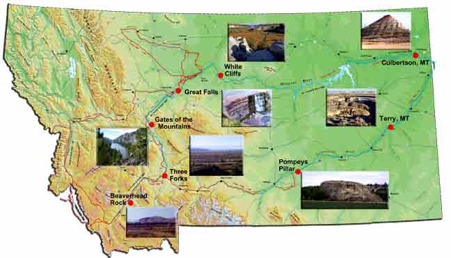
- Navigation
- Equipment
- Culbertson
- White Cliffs
- Great Falls
- Gates of the Mountains
- Three Forks of the Missouri
- Beaverhead Rock
- Pompeys Pillar
- Terry
On their way....
The Lewis and Clark Expedition
started up the Missouri on May 14, 1804. Theirs was a scientific
mission—to discover what they could about the upper Missouri
and a connecting route from its headwaters to the Pacific. Along
the way, Lewis and Clark took and recorded magnetic bearings of
the river’s course, estimating the distance of each course.
They also recorded aspects of the climate, geography and geology.
By the time the expedition reached what is now Montana (April 27,
1805), it had logged more than 1900 river miles. The expedition
exited Montana on September 13, 1805 at Lolo Pass and re-entered
Montana at that same pass on June 29, 1806. By August 3, 1806 Clark
had reached Montana’s eastern border. Lewis passed that
border on August 7.
 |
| Photo courtesy of American Philosophical Society |
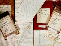
A record of their observations
Lewis and Clark and several
of the enlisted men kept journals in which they recorded the events
of the day and their observations. The captains’ journals
were published in 1814, but most of the geological, botanical
and navigational entries were deleted. When the original manuscript
journals of Captains' Lewis and Clark were rediscovered in the
early 1890s and published in 1904-05, new interest developed in
the expedition.
Since 1905, additional original materials have been discovered, and interest remains strong as the spirit of the expedition continues through the present day. The first description of Lewis and Clark’s geological observations begins on April 28, 1805.
    |